You can use the mosquito mapper tool to track when mosquitos are breeding in your area. Spring is a great time to start using the GLOBE Observer Mosquito Habitat Mapper.
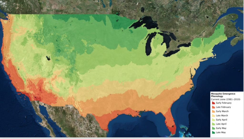
Have you noticed any mosquitoes yet? Spring is upon us in the United States, and mosquitoes are already buzzing in many parts of the country. Below is a map that shows the approximate onset of the mosquito session throughout the contiguous U.S. You can observe how the mosquito season works its way northward as conditions become suitable for them to hatch and breed. If you don’t see mosquitoes already, take a look to this map to see when you can start expecting them:
Mosquito Eaters
Do mosquito eaters actually eat mosquitos? Find out.
DO MOSQUITO EATERS EAT MOSQUITOS?
Mosquito Mapper: A Global Citizen Science Tool
Anyone, anywhere in the world can download the GLOBE Observer Mosquito Habitat Mapper app to get started with this project. The Globe Observer Mosquito Habitat Mapper urges users to locate and map locations of mosquito breeding sites, as well as decommission container habitats so that mosquito larvae don’t develop into adult disease vectors.
Beyond promoting the collection of critical data for use by scientists and health officials, this project fosters understanding of the importance of personal action in reducing the local risk of vector-borne disease.When you sign into the app, add “SciStarter” in the referral field to earn credit for your contributions on your SciStarter account dashboard.
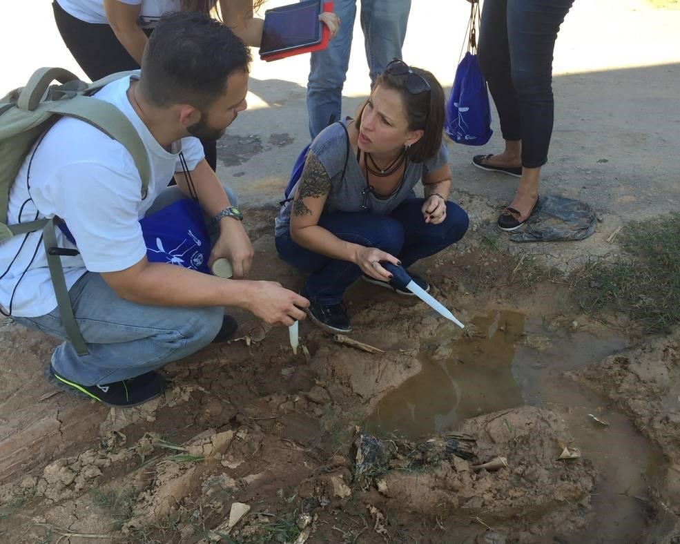
The Mosquito Habitat Mapper is suitable for citizen scientists of all ages, because it is designed so users can choose their level of engagement. Participants can take their mobile device with them on a walk and simply take pictures of standing water (which is a potential mosquito breeding habitat) and take a look to see if they see any larvae in the water (the app will show you what you are looking for). If interest and time permits, citizen scientists can take a cup or bulb pipette to sample the mosquito larvae and proceed with identification, using the key in the Mosquito Habitat Mapper and a clip-on magnifier. The key identifies several taxa that have the potential to transmit disease. If the standing water is not there for a purpose, users are instructed to remove the habitat from use by dumping out the water. Standing water that is being collected purposefully can also be taken out-of-use as a mosquito breeding site by covering the container with a net or lid or by applying larvicide. By doing one or more of the tasks listed in the Mosquito Habitat Mapper, users become aware of how they can reduce risk of disease in their community by mitigating breeding habitats.
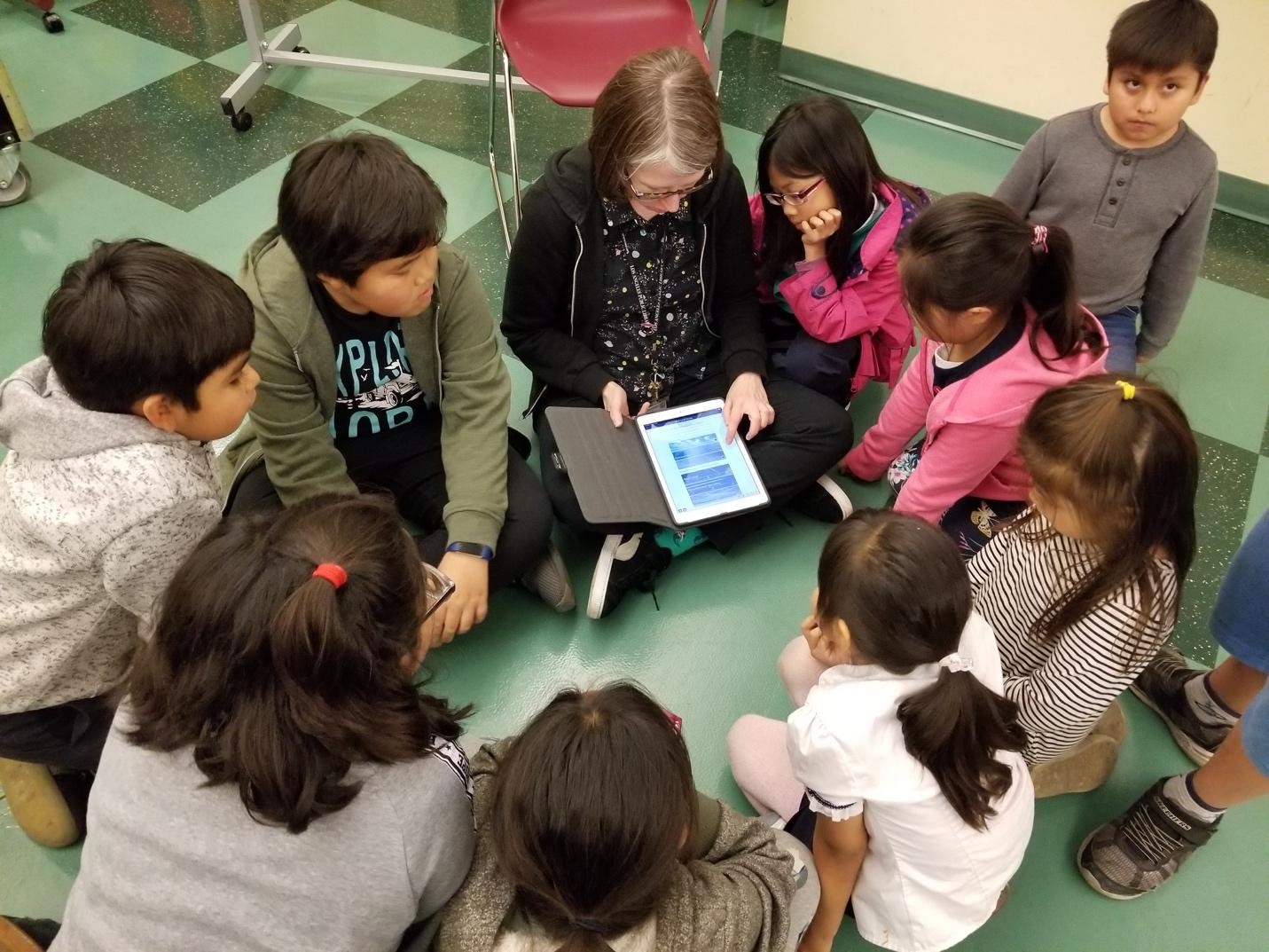
Community Engagement Through Citizen Science
The Mosquito Habitat Mapper is a tool that can bring communities together. For example, several libraries have included activities featuring the Mosquito Habitat Mapper in their science programming. Jennifer Beach, an environmental educator at Kenton County Public Library in Erlanger, Kentucky, noted, “After hosting a BioBlitz last fall, it was apparent to me that there is lots of interest in the community for citizen science events, and the Mosquito Habitat Mapper seemed like a simple but engaging way to possibly get more people involved. As there is increased rain and longer warm months in the spring and summer in our area, mosquitoes may become more of an issue from a health standpoint.”
As the program progresses, Kenton County Public Library will be getting the public involved in making mosquito traps, sampling water in containers around the library, and reporting the data to the GLOBE database.
RELATED: Want to get less mosquito bites? New Clues Into How Aedes Mosquitoes Detect Human Targets
Amy-Jane McWilliam, Youth Services Programming Coordinator, Lee County Library System, Fort Myers, FL described why they have adopted the Mosquito Habitat Mapper in their outreach. “We are a coastal community that recently went through a devastating toxic algae bloom that killed many sea life and had a huge economic impact on our county. This has resulted in a greater interest in science and the environment. Being part of the GLOBE Mission Mosquito campaign is a great way to show our community how they can help scientists discover solutions to help our community.”
Mosquito Mapper: A Tool For Solving Real Problems
McWilliam noted that mosquitos are a huge problem in Southwest Florida. “Our summers are filled with rainy afternoons and standing water. This project sheds light on the simple things our community can do to prevent mosquitoes from thriving and also prevent the spread of mosquito-borne viruses like Zika and West Nile.“
In Lee County, the Northwest Regional Library has incorporated Mosquito Habitat Mapper in their monthly STEAM club for elementary students, and Pine Island Library in this county is offering a family program showing islanders how to make a mosquito trap and how to use the Mosquito Habitat Mapper to identify and report sites with standing water, which pose a potential health risk.
Danielle Burns, a librarian at the Laredo Public Library in Texas, said that mosquitoes are definitely a problem in that area, especially since there are lots of ranches and mosquitoes can harm livestock. At the Lamar Bruni Vergara Inner City Branch, she is using Mosquito Habitat Mapper and hands-on activities and games from the new GLOBE Observer Toolkits for Informal Educators in her programs, working with a local homeschooling group and working with schools to promote the awareness of mosquitoes and the importance of tracking their habitats and activities.
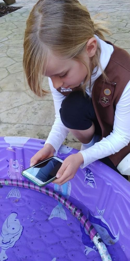
In addition to (and sometimes in conjunction with libraries), the Girl Scouts Think Like a Citizen Scientist Journey has girls in troops around the country participating in Mosquito Habitat Mapper citizen science. Brownie Scout leader Tassia Owens said, “Kids are scientists inherently. They are always asking questions and observing the world around them. The Think Like a Citizen Scientist Journey allows Girl Scouts to use their natural scientific instincts in a real-world scientific application. But the best part is that Girl Scouts make a promise to help others at all times. The data they collect for GLOBE Mission Mosquito is used to help people by identifying breeding grounds of vector borne illness carrying mosquitoes.”
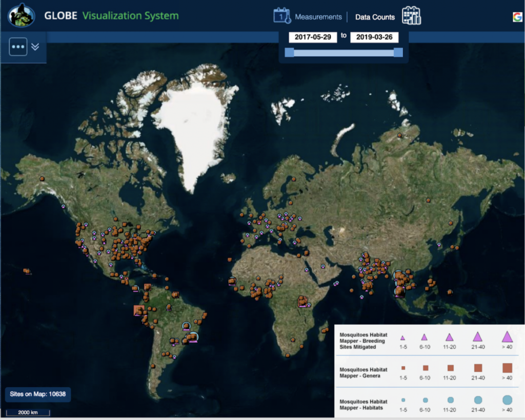
By reporting mosquito data, you are contributing to an international effort to document where potential vectors of disease have been observed. Anyone can examine the data that has been collected and conduct data analysis using tools built into the GLOBE Data Visualization System.
About the Authors
Dr. Russanne Low is a senior scientist at IGES and is the science lead for GLOBE Mission Mosquito. She lives in Boulder, CO.
Theresa Schwerin is Vice President, Education, Institute for Global Environmental Strategies (IGES), Arlington, VA. She is Principal Investigator for the NASA Earth Science Education Collaborative and liaison to the Library community for GLOBE Observer.
Liz Burke is a senior science education specialist at IGES and is a member of the GLOBE Mission Mosquito team. She lives in Kasilof, AK.
GLOBE Mission Mosquito is co-led by NASA Goddard Space Flight Center (GSFC) and the Institute for Global Environmental Strategies (IGES), working in collaboration with the GLOBE Implementation Office. This project is based upon work supported by NASA under IGES award No. NNX16AE28A: NASA Earth Science Education Collaborative (NESEC).